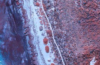
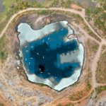
Monitoring shorelines and seawalls is essential to ensuring the safety of local dwellers, allowing maintenance to be scheduled before hazards occur.
APPLICATIONS
- Track/monitor erosion over time
- Assess condition of embankments, retaining walls, jetties and pontoons
- Monitor tops and toes of seawalls
- Assessment and monitoring of mangrove health
- Weed detection and volumetric calculations along coastlines
- Survey large areas or long linear flight paths in a short time
- Bathymetric surveys to map terrain under water
BENEFITS
- Minimises risk to maintenance crews by removing the need to physically access hazardous areas and remote environments
- Faster and more cost -effective data capture compared to conventional methods
- Optimise maintenance schedules and keep a record of historical changes over time
- Minimal noise, disruption or risk to local community and wildlife
- Easy reporting for environmental compliance requirements
Related Use Cases:
Bathymetric Surveys
Using sonar sensors, we conduct bathymetric surveys to map underwater features and measure depths.
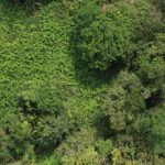
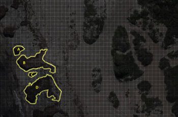
Weed Mapping
Control of weed growth is crucial to maintaining productivity gains and sustainable herbicide use.