Increasing efficiency with VTOL

What is VTOL and how does it work?
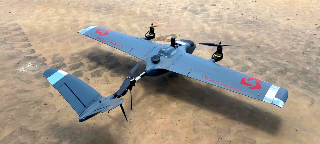
VTOL is the acronym for Vertical Take Off and Landing. This term is commonly used to describe the concept of movement in UAV’s (Unmanned Aerial Vehicles). VTOL refers to an aircraft that can take off, hover and land vertically.
VTOLs are considerably efficient as they combine the vertical flight of a multirotor aircraft with the forward air travel of a fixed-wing aircraft. This combination of techniques therefore provides a solution with optimal characteristics.

+ Advantages of VTOL
Since the VTOL combines the advantages of multirotor and the advantages of fixed-wing aircraft, it is evidently more flexible and adaptable. Its strongest features are its:
- efficient manoeuvrability
- ability to hover steadily
- capability to take off and land in heavy wind
- minimal horizontal space required to launch a VTOL aircraft as opposed to a fixed-wing aircraft which requires a runway or a large open space
- speed to capture results compared to a multirotor drone meaning that the operation time for each project can be minimised
- ability to tilt to a certain level to compensate the wind, ensuring that the aircraft maximises stability and safety during landing and take offs.
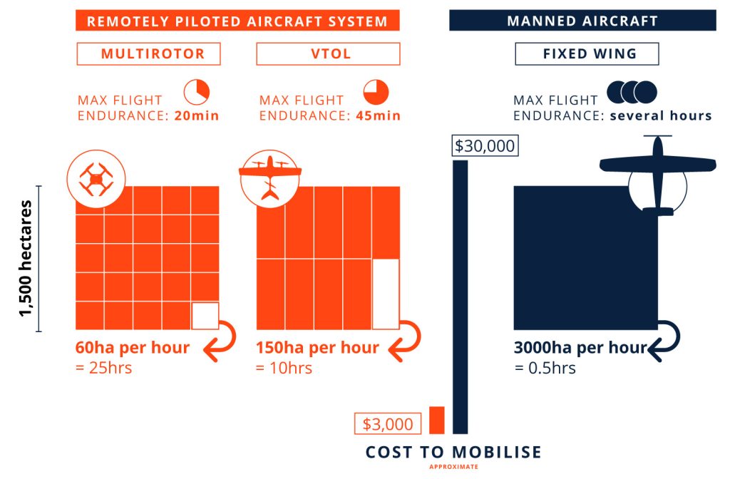
- a fraction of the cost to mobilise in comparison to manned aircraft operations
– Limitations of VTOL
Despite the extensive advantages of VTOL, it is important to recognise its main limitations:
- slower, and therefore less coverage, compared to manned aircraft
- requires a certified operator licensed for Powered Lift platforms (more rare than multirotor and fixed wing categories)
When is it useful?
- Surveying areas larger than 500 hectares
- Operations in areas lacking sufficient space for launching and landing fixed-wing platforms
- Operations in windy conditions
- Approx 10% of the cost of operating manned aircraft
Cost vs Efficiency:
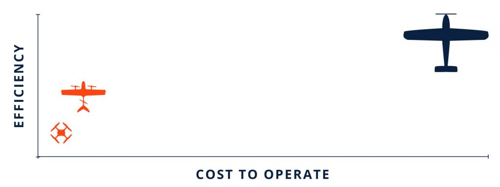
On a scale of cost vs efficiency, the VTOL is positioned comfortably between multirotor platforms and manned aircraft.

For aerial surveys greater than 500 hectares, the VTOL platform is far more efficient than using a multirotor platform, far most cost-effective than using manned aircraft, and is capable of producing highly accurate data and powerful insights.
This infographic demonstrates the comparison between using Multirotor, VTOL systems and manned aircraft to survey the same area measuring 1,500 hectares. All data is approximate for a typical scenario and is indicative only.

Related Articles: Aerial Surveys by drone, Strengths & Limitations of Photogrammetry, RTK and PPK Drone Surveys, LiDAR or Photogrammetry
Contact us today to learn more.


